
Schwander Grat topographic map
Interactive map
Click on the map to display elevation.
About this map
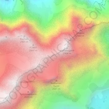
Name: Schwander Grat topographic map, elevation, terrain.
Location: Schwander Grat, Klöntalerstrasse, Glarus, 6667, Schweiz (47.00543 9.01042 47.00681 9.01434)
Average elevation: 7,438 ft
Minimum elevation: 4,682 ft
Maximum elevation: 9,514 ft
Other topographic maps
Click on a map to view its topography, its elevation and its terrain.
Klöntalersee
Klöntalersee, Seestrasse, Plätz, Glarus, 6667, Schweiz
Average elevation: 4,698 ft
Glärnischfirn
Glärnischfirn, Seestrasse, Plätz, Glarus, 6667, Schweiz
Average elevation: 7,818 ft