
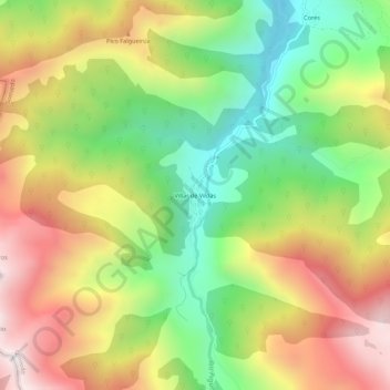
Villar de Vildas topographic map
Interactive map
Click on the map to display elevation.
About this map
Name: Villar de Vildas topographic map, elevation, terrain.
Location: Villar de Vildas, Somiedo, Asturias, 33842, España (43.07081 -6.35640 43.11081 -6.31640)
Average elevation: 4,055 ft
Minimum elevation: 2,451 ft
Maximum elevation: 5,896 ft
Other topographic maps
Click on a map to view its topography, its elevation and its terrain.
Pico los Raxos
Pico los Raxos, Somiedo, Asturias, España
Average elevation: 5,594 ft
Parque Natural de Somiedo
Parque Natural de Somiedo, Somiedo, Asturias, 33840, España
Average elevation: 4,262 ft
Pola de Somiedo
Pola de Somiedo, Somiedo, Asturias, 33840, España
Average elevation: 3,494 ft
Peña Prieta
Peña Prieta, Somiedo, Asturias, España
Average elevation: 5,253 ft