
Kheneg topographic map
Interactive map
Click on the map to display elevation.
About this map
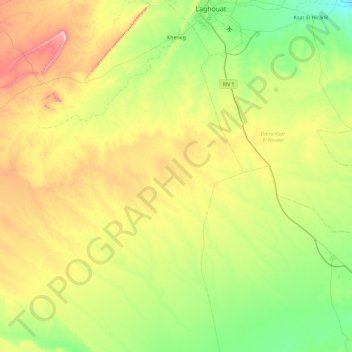
Name: Kheneg topographic map, elevation, terrain.
Location: Kheneg, Daïra Ain Madhi, Laghouat, Algérie (33.06201 2.42672 33.82436 2.96680)
Average elevation: 2,736 ft
Minimum elevation: 2,238 ft
Maximum elevation: 3,809 ft