
Burroughs Wood topographic map
Interactive map
Click on the map to display elevation.
About this map
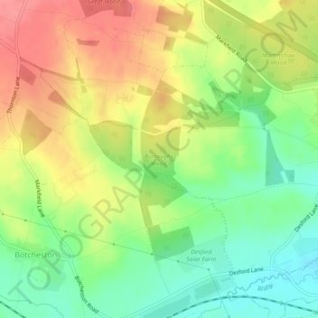
Name: Burroughs Wood topographic map, elevation, terrain.
Average elevation: 374 ft
Minimum elevation: 246 ft
Maximum elevation: 509 ft
Other topographic maps
Click on a map to view its topography, its elevation and its terrain.
Merry Lees
United Kingdom > England > Leicestershire > Hinckley and Bosworth > Botcheston
Merry Lees, Bagworth & Thornton, Botcheston, Hinckley and Bosworth, Leicestershire, England, LE67 1AP, United Kingdom
Average elevation: 413 ft