
Glenwood Park topographic map
Interactive map
Click on the map to display elevation.
About this map
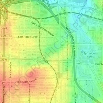
Name: Glenwood Park topographic map, elevation, terrain.
Average elevation: 587 ft
Minimum elevation: 505 ft
Maximum elevation: 663 ft
Other topographic maps
Click on a map to view its topography, its elevation and its terrain.
Moselle
United States > Texas > Tarrant County > Fort Worth
Moselle, Fort Worth, Tarrant County, Texas, 76134, United States
Average elevation: 764 ft
Rendon
United States > Texas > Tarrant County > Fort Worth
Rendon, Fort Worth, Tarrant County, Texas, United States
Average elevation: 725 ft
Fort Worth
United States > Texas > Tarrant County > Fort Worth
Fort Worth, Tarrant County, Texas, 76102, United States
Average elevation: 663 ft
Ederville
United States > Texas > Tarrant County > Fort Worth > Ederville
Ederville, Fort Worth, Tarrant County, Texas, 76112, United States
Average elevation: 614 ft