Janesville topographic map
Interactive map
Click on the map to display elevation.
About this map
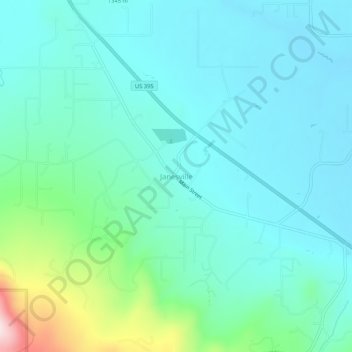
Name: Janesville topographic map, elevation, terrain.
Average elevation: 4,370 ft
Minimum elevation: 4,114 ft
Maximum elevation: 5,489 ft

Click on the map to display elevation.
Name: Janesville topographic map, elevation, terrain.
Average elevation: 4,370 ft
Minimum elevation: 4,114 ft
Maximum elevation: 5,489 ft