
岳西县 topographic map
Interactive map
Click on the map to display elevation.
About this map
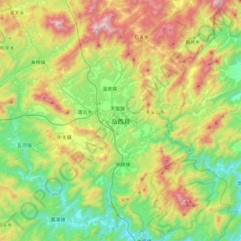
Name: 岳西县 topographic map, elevation, terrain.
Location: 岳西县, 天堂镇, 岳西县, 安庆市, 安徽省, 中国 (30.69186 116.19465 31.01186 116.51465)
Average elevation: 1,880 ft
Minimum elevation: 167 ft
Maximum elevation: 5,033 ft