
Sungai Penuh topographic map
Interactive map
Click on the map to display elevation.
About this map
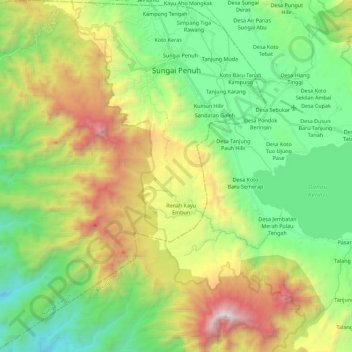
Name: Sungai Penuh topographic map, elevation, terrain.
Location: Sungai Penuh, Hamparan Rawang, Jambi, Indonesia (-2.25100 101.23968 -2.02613 101.45381)
Average elevation: 3,720 ft
Minimum elevation: 1,358 ft
Maximum elevation: 8,255 ft