
Goral Dhar topographic map
Interactive map
Click on the map to display elevation.
About this map
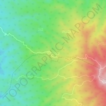
Name: Goral Dhar topographic map, elevation, terrain.
Location: Goral Dhar, Jaswan, Kangra District, Himachal Pradesh, India (31.84770 76.00246 31.88770 76.04246)
Average elevation: 2,293 ft
Minimum elevation: 1,811 ft
Maximum elevation: 3,018 ft