
Herk-de-Stad topographic map
Interactive map
Click on the map to display elevation.
About this map
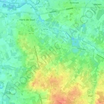
Name: Herk-de-Stad topographic map, elevation, terrain.
Location: Herk-de-Stad, Hasselt, Limburg, Flanders, 3540, Belgium (50.89249 5.13717 50.95188 5.22997)
Average elevation: 108 ft
Minimum elevation: 59 ft
Maximum elevation: 194 ft