
Aldea San Gregorio topographic map
Interactive map
Click on the map to display elevation.
About this map
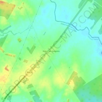
Name: Aldea San Gregorio topographic map, elevation, terrain.
Average elevation: 115 ft
Minimum elevation: 69 ft
Maximum elevation: 190 ft
Other topographic maps
Click on a map to view its topography, its elevation and its terrain.
Parque Nacional El Palmar
Argentina > Entre Ríos > Distrito Sexto
Parque Nacional El Palmar, Distrito Sexto, Departamento Colón, Entre Ríos, Argentina
Average elevation: 95 ft
Ubajay
Argentina > Entre Ríos > Distrito Sexto
Ubajay, Municipio de Ubajay, Distrito Sexto, Departamento Colón, Entre Ríos, E3287AWA, Argentina
Average elevation: 164 ft