
Tupelo topographic map
Interactive map
Click on the map to display elevation.
About this map
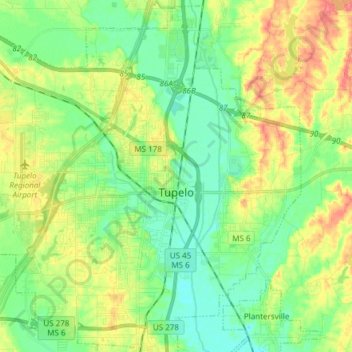
Name: Tupelo topographic map, elevation, terrain.
Location: Tupelo, Lee County, Mississippi, United States (34.20243 -88.80086 34.32413 -88.64969)
Average elevation: 308 ft
Minimum elevation: 233 ft
Maximum elevation: 427 ft
Lee County trails, hiking, mountain biking, running and outdoor activities
Other topographic maps
Click on a map to view its topography, its elevation and its terrain.