
Corbin topographic map
Interactive map
Click on the map to display elevation.
About this map
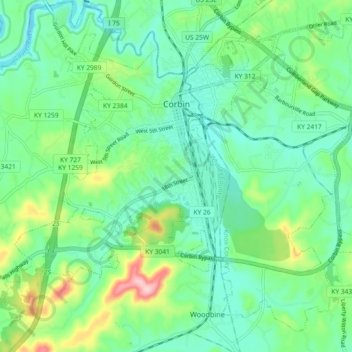
Name: Corbin topographic map, elevation, terrain.
Location: Corbin, Whitley County, Kentucky, United States (36.90125 -84.14230 36.96585 -84.05063)
Average elevation: 1,181 ft
Minimum elevation: 997 ft
Maximum elevation: 1,686 ft
Whitley County trails, hiking, mountain biking, running and outdoor activities
Other topographic maps
Click on a map to view its topography, its elevation and its terrain.