
Pascagoula topographic map
Interactive map
Click on the map to display elevation.
About this map
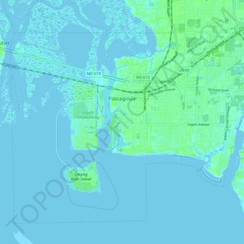
Name: Pascagoula topographic map, elevation, terrain.
Location: Pascagoula, Jackson County, Mississippi, United States (30.31725 -88.60755 30.39411 -88.50053)
Average elevation: 7 ft
Minimum elevation: -13 ft
Maximum elevation: 39 ft
Jackson County trails, hiking, mountain biking, running and outdoor activities
Other topographic maps
Click on a map to view its topography, its elevation and its terrain.