
Wood River topographic map
Interactive map
Click on the map to display elevation.
About this map
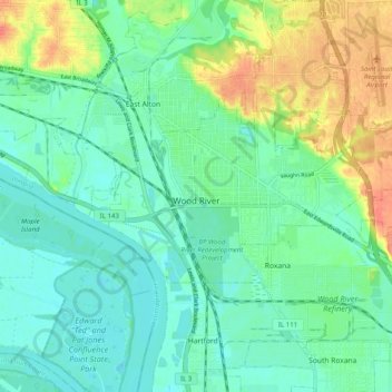
Name: Wood River topographic map, elevation, terrain.
Location: Wood River, Madison County, Illinois, 62095, United States (38.84255 -90.12015 38.88156 -90.02032)
Average elevation: 453 ft
Minimum elevation: 397 ft
Maximum elevation: 574 ft
Madison County trails, hiking, mountain biking, running and outdoor activities
Other topographic maps
Click on a map to view its topography, its elevation and its terrain.