
Cedar Island topographic map
Interactive map
Click on the map to display elevation.
About this map
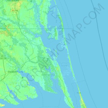
Name: Cedar Island topographic map, elevation, terrain.
Location: Cedar Island, Currituck County, North Carolina, USA (36.07988 -76.26048 36.71988 -75.62048)
Average elevation: 3 ft
Minimum elevation: -13 ft
Maximum elevation: 52 ft
Other topographic maps
Click on a map to view its topography, its elevation and its terrain.