
Rockville topographic map
Interactive map
Click on the map to display elevation.
About this map
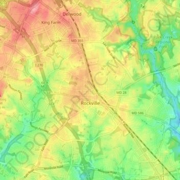
Name: Rockville topographic map, elevation, terrain.
Location: Rockville, Montgomery County, Maryland, United States (39.05329 -77.20015 39.12050 -77.10781)
Average elevation: 400 ft
Minimum elevation: 246 ft
Maximum elevation: 551 ft
Montgomery County trails, hiking, mountain biking, running and outdoor activities
Other topographic maps
Click on a map to view its topography, its elevation and its terrain.
Upper Long Branch Neighborhood Park
United States > Maryland > Montgomery County > Four Corners
Average elevation: 285 ft
Hungerford Towne
United States > Maryland > Montgomery County > Rockville > Hungerford Towne
Average elevation: 400 ft
Clearspring Manor
United States > Maryland > Montgomery County > Damascus > Clearspring Manor
Average elevation: 705 ft