
Woodstock topographic map
Interactive map
Click on the map to display elevation.
About this map
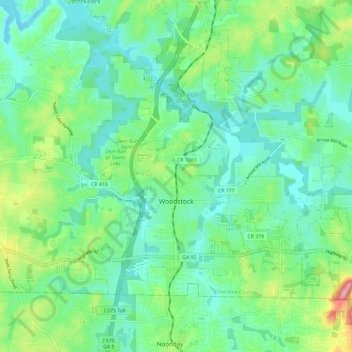
Name: Woodstock topographic map, elevation, terrain.
Location: Woodstock, Cherokee County, Georgia, United States (34.07411 -84.56680 34.14239 -84.44965)
Average elevation: 971 ft
Minimum elevation: 823 ft
Maximum elevation: 1,388 ft
Cherokee County trails, hiking, mountain biking, running and outdoor activities
Other topographic maps
Click on a map to view its topography, its elevation and its terrain.