
Lasne topographic map
Interactive map
Click on the map to display elevation.
About this map
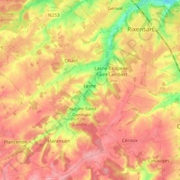
Name: Lasne topographic map, elevation, terrain.
Location: Lasne, Nivelles, Walloon Brabant, Wallonia, 1380, Belgium (50.64394 4.39485 50.72418 4.52638)
Average elevation: 351 ft
Minimum elevation: 128 ft
Maximum elevation: 492 ft