
Grinda topographic map
Interactive map
Click on the map to display elevation.
About this map
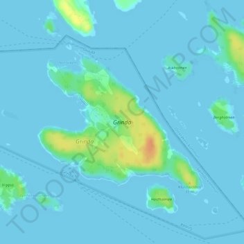
Name: Grinda topographic map, elevation, terrain.
Location: Grinda, Värmdö, Stockholm County, Region Svealand, Sweden (59.40419 18.54601 59.42039 18.58209)
Average elevation: 13 ft
Minimum elevation: -7 ft
Maximum elevation: 118 ft
Other topographic maps
Click on a map to view its topography, its elevation and its terrain.