
powiat sulęciński topographic map
Interactive map
Click on the map to display elevation.
About this map
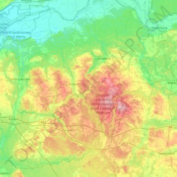
Name: powiat sulęciński topographic map, elevation, terrain.
Location: powiat sulęciński, Lubusz Voivodeship, Poland (52.20483 14.64731 52.65208 15.44974)
Average elevation: 249 ft
Minimum elevation: 33 ft
Maximum elevation: 735 ft
Other topographic maps
Click on a map to view its topography, its elevation and its terrain.