
Topton topographic map
Interactive map
Click on the map to display elevation.
About this map
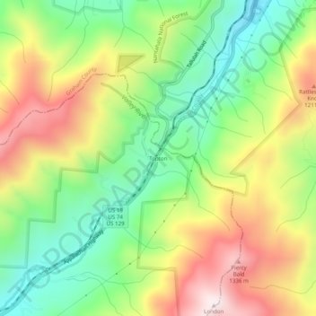
Name: Topton topographic map, elevation, terrain.
Location: Topton, Cherokee County, North Carolina, United States (35.22703 -83.72323 35.26703 -83.68323)
Average elevation: 3,215 ft
Minimum elevation: 2,205 ft
Maximum elevation: 4,554 ft
Cherokee County trails, hiking, mountain biking, running and outdoor activities
Other topographic maps
Click on a map to view its topography, its elevation and its terrain.