
Winter Hill topographic map
Interactive map
Click on the map to display elevation.
Winter Hill
Paths to the summit lead from Belmont (in Blackburn with Darwen), Rivington (in Chorley borough), and Horwich and Blackrod (in Bolton borough). The summit can also be reached via a short walk from the top of a road pass 1+1⁄4 miles (2 km) west of Belmont. The hill is a prominent feature on the skyline for most of the borough of Chorley and further afield. Winter Hill's topographic prominence results in it being classified as a Marilyn. The trig point on its summit marks the highest point in Blackburn with Darwen whereas the highest point in the Metropolitan Borough of Bolton is 440 yards (400 m) away on its south east slope at 1,467 feet (447 m) above sea level.
About this map
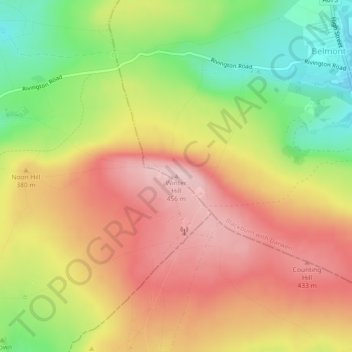
Name: Winter Hill topographic map, elevation, terrain.
Average elevation: 1,171 ft
Minimum elevation: 774 ft
Maximum elevation: 1,496 ft