
Belle Plaine topographic map
Interactive map
Click on the map to display elevation.
About this map
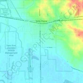
Name: Belle Plaine topographic map, elevation, terrain.
Location: Belle Plaine, Benton County, Iowa, 52208, United States (41.86852 -92.29800 41.90662 -92.25001)
Average elevation: 807 ft
Minimum elevation: 758 ft
Maximum elevation: 965 ft
Benton County trails, hiking, mountain biking, running and outdoor activities
Other topographic maps
Click on a map to view its topography, its elevation and its terrain.