
Joaquín Suárez topographic map
Interactive map
Click on the map to display elevation.
About this map
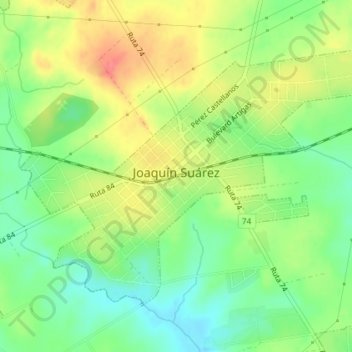
Name: Joaquín Suárez topographic map, elevation, terrain.
Location: Joaquín Suárez, Canelones, 15500, Uruguay (-34.74669 -56.05112 -34.72509 -56.01496)
Average elevation: 151 ft
Minimum elevation: 56 ft
Maximum elevation: 266 ft