
Swains Island topographic map
Interactive map
Click on the map to display elevation.
About this map
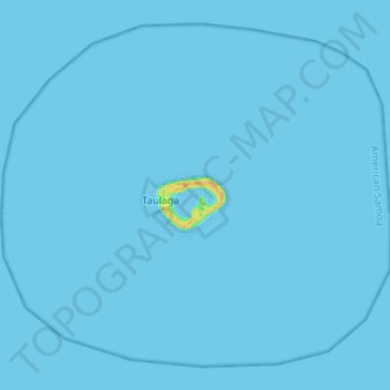
Name: Swains Island topographic map, elevation, terrain.
Location: Swains Island, American Samoa, United States (-11.11013 -171.14191 -10.99720 -171.01116)
Average elevation: 0 ft
Minimum elevation: -10 ft
Maximum elevation: 79 ft
American Samoa trails, hiking, mountain biking, running and outdoor activities
Other topographic maps
Click on a map to view its topography, its elevation and its terrain.
Nua-Seetaga Bay
United States > American Samoa > Western District > Se'etaga
Average elevation: 289 ft