
Catalina Island topographic map
Interactive map
Click on the map to display elevation.
About this map
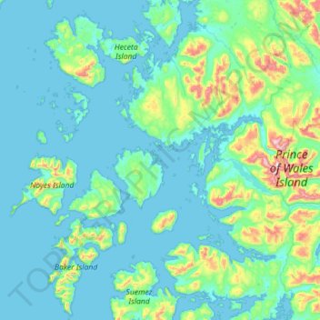
Name: Catalina Island topographic map, elevation, terrain.
Location: Catalina Island, Prince of Wales-Hyder, Alaska, USA (55.22760 -133.61267 55.86760 -132.97267)
Average elevation: 404 ft
Minimum elevation: -30 ft
Maximum elevation: 3,793 ft
Other topographic maps
Click on a map to view its topography, its elevation and its terrain.