
Plaster Rock topographic map
Interactive map
Click on the map to display elevation.
About this map
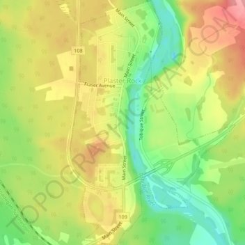
Name: Plaster Rock topographic map, elevation, terrain.
Average elevation: 495 ft
Minimum elevation: 322 ft
Maximum elevation: 663 ft
Other topographic maps
Click on a map to view its topography, its elevation and its terrain.
Wapske
Canada > New Brunswick > Gordon Parish
Wapske, Gordon Parish, Victoria County, New Brunswick, E7G 2E4, Canada
Average elevation: 449 ft
Plaster Rock
Canada > New Brunswick > Gordon Parish
Plaster Rock, Gordon Parish, Victoria County, New Brunswick, E7G 2E4, Canada
Average elevation: 495 ft
Arthurette
Canada > New Brunswick > Gordon Parish
Arthurette, Gordon Parish, Victoria County, New Brunswick, E7H 4H7, Canada
Average elevation: 423 ft