
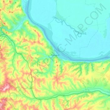
Grocka Urban Municipality topographic map
Interactive map
Click on the map to display elevation.
About this map
Name: Grocka Urban Municipality topographic map, elevation, terrain.
Average elevation: 479 ft
Minimum elevation: 217 ft
Maximum elevation: 1,299 ft
The municipality is located east of Belgrade, in the northern part of Šumadija region, with the northern section being part of the Podunavlje macro-region in the valley of the Danube, while the southern section is located around the valley of the Ralja River, which is a tributary to the Velika Morava's arm of Jezava. With an altitude of 71 meters above sea level, the town of Grocka is one of the lowest parts of Belgrade. Other rivers in the municipality are Bolečica and Gročica. Being polluted, by 2019 the environmentalists described both rivers as "less of a watercourses, more of a sewage watersheds".
Other topographic maps
Click on a map to view its topography, its elevation and its terrain.
Drlupa
Serbia > Central Serbia > City of Belgrade > Sopot Urban Municipality
Drlupa, Sopot Urban Municipality, City of Belgrade, Central Serbia, Serbia
Average elevation: 712 ft
Mladenovac Urban Municipality
Serbia > Central Serbia > City of Belgrade
Mladenovac Urban Municipality, City of Belgrade, Central Serbia, Serbia
Average elevation: 692 ft
Belgrade
Serbia > Central Serbia > City of Belgrade
Belgrade, City of Belgrade, Central Serbia, Serbia
Average elevation: 354 ft
Vracar
Serbia > Central Serbia > City of Belgrade > Belgrade
Vracar, Vracar Urban Municipality, Belgrade, City of Belgrade, Central Serbia, 11000, Serbia
Average elevation: 410 ft
Cukarica Urban Municipality
Serbia > Central Serbia > City of Belgrade
Cukarica Urban Municipality, City of Belgrade, Central Serbia, Serbia
Average elevation: 436 ft
Palilula Urban Municipality
Serbia > Central Serbia > City of Belgrade
Palilula Urban Municipality, City of Belgrade, Central Serbia, 11000, Serbia
Average elevation: 272 ft
Zemun
Serbia > Central Serbia > City of Belgrade > Belgrade
Zemun, Belgrade, City of Belgrade, Central Serbia, 11000, Serbia
Average elevation: 262 ft
New Belgrade
Serbia > Central Serbia > City of Belgrade > Belgrade
New Belgrade, New Belgrade Urban Municipality, Belgrade, City of Belgrade, Central Serbia, 11000, Serbia
Average elevation: 318 ft
Beli Potok
Serbia > Central Serbia > City of Belgrade
Beli Potok, City of Belgrade, Central Serbia, 11223, Serbia
Average elevation: 659 ft
Mirijevo
Serbia > Central Serbia > City of Belgrade > Belgrade
Mirijevo, Zvezdara, Zvezdara Urban Municipality, Belgrade, City of Belgrade, Central Serbia, 11050, Serbia
Average elevation: 614 ft
Beli Potok
Serbia > Central Serbia > City of Belgrade > Beli Potok
Beli Potok, Vozdovac Urban Municipality, City of Belgrade, Central Serbia, 11040, Serbia
Average elevation: 715 ft