
Appalachian topographic map
Interactive map
Click on the map to display elevation.
About this map
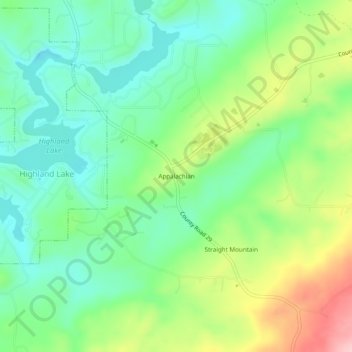
Name: Appalachian topographic map, elevation, terrain.
Location: Appalachian, Blount County, Alabama, United States (33.86482 -86.42193 33.90482 -86.38193)
Average elevation: 1,063 ft
Minimum elevation: 860 ft
Maximum elevation: 1,453 ft
Blount County trails, hiking, mountain biking, running and outdoor activities
Other topographic maps
Click on a map to view its topography, its elevation and its terrain.
Rickwood Caverns State Park
United States > Alabama > Blount County > Warrior > Reids
Average elevation: 738 ft