
Nordhorn topographic map
Interactive map
Click on the map to display elevation.
About this map
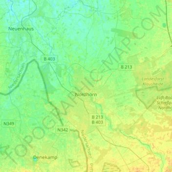
Name: Nordhorn topographic map, elevation, terrain.
Location: Nordhorn, Landkreis Grafschaft Bentheim, Lower Saxony, Germany (52.35973 6.99845 52.52751 7.20306)
Average elevation: 79 ft
Minimum elevation: 49 ft
Maximum elevation: 121 ft