
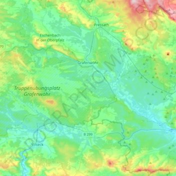
Grafenwöhr topographic map
Interactive map
Click on the map to display elevation.
About this map
Name: Grafenwöhr topographic map, elevation, terrain.
Average elevation: 1,476 ft
Minimum elevation: 1,260 ft
Maximum elevation: 2,228 ft
Other topographic maps
Click on a map to view its topography, its elevation and its terrain.
Windischeschenbach
Germany > Bavaria > Landkreis Neustadt an der Waldnaab
Windischeschenbach, Landkreis Neustadt an der Waldnaab, Bavaria, 92670, Germany
Average elevation: 1,627 ft
Pressath
Germany > Bavaria > Landkreis Neustadt an der Waldnaab
Pressath, Pressath (VGem), Landkreis Neustadt an der Waldnaab, Bavaria, 92690, Germany
Average elevation: 1,542 ft
Eslarn
Germany > Bavaria > Landkreis Neustadt an der Waldnaab > Eslarn
Eslarn, Landkreis Neustadt an der Waldnaab, Bavaria, 92693, Germany
Average elevation: 1,834 ft