
Distrito Remedios topographic map
Interactive map
Click on the map to display elevation.
About this map
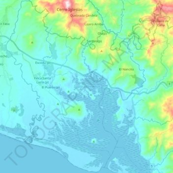
Name: Distrito Remedios topographic map, elevation, terrain.
Location: Distrito Remedios, Chiriquí, Panama (8.12788 -81.86676 8.31663 -81.71306)
Average elevation: 322 ft
Minimum elevation: -13 ft
Maximum elevation: 2,260 ft
Other topographic maps
Click on a map to view its topography, its elevation and its terrain.
Embalse Río Caldera
Panama > Chiriquí > Distrito de Boquete > Alto Boquete
Average elevation: 3,537 ft