
La Estrella topographic map
Interactive map
Click on the map to display elevation.
About this map
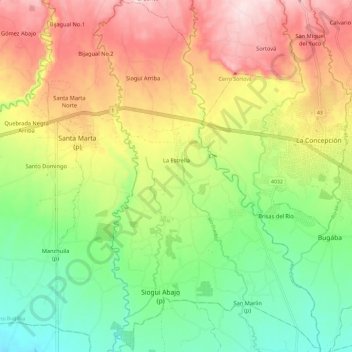
Name: La Estrella topographic map, elevation, terrain.
Location: La Estrella, Distrito Bugaba, Chiriquí, Panama (8.44877 -82.69889 8.56523 -82.62324)
Average elevation: 689 ft
Minimum elevation: 164 ft
Maximum elevation: 1,348 ft