
East Suffolk topographic map
Interactive map
Click on the map to display elevation.
About this map
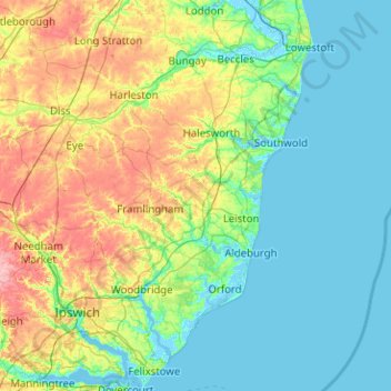
Name: East Suffolk topographic map, elevation, terrain.
Location: East Suffolk, Suffolk, East of England, England, United Kingdom (51.93212 1.15781 52.55022 1.76891)
Average elevation: 72 ft
Minimum elevation: -13 ft
Maximum elevation: 308 ft
Other topographic maps
Click on a map to view its topography, its elevation and its terrain.