
Saint John topographic map
Interactive map
Click on the map to display elevation.
About this map
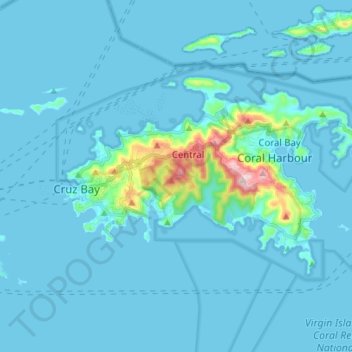
Name: Saint John topographic map, elevation, terrain.
Average elevation: 85 ft
Minimum elevation: 0 ft
Maximum elevation: 1,240 ft
Saint Thomas - Saint John District trails, hiking, mountain biking, running and outdoor activities