
Thank you for supporting this site ❤️
Make a donation
Make a donation
Farwaniya topographic map
Interactive map
Click on the map to display elevation.


About this map
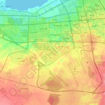
Name: Farwaniya topographic map, elevation, terrain.
Location: Farwaniya, Kuwait (29.17958 47.80358 29.31695 48.00811)
Average elevation: 121 ft
Minimum elevation: -13 ft
Maximum elevation: 236 ft
Other topographic maps
Click on a map to view its topography, its elevation and its terrain.