
Bridgton topographic map
Interactive map
Click on the map to display elevation.
About this map
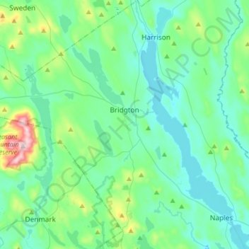
Name: Bridgton topographic map, elevation, terrain.
Location: Bridgton, Cumberland County, Maine, 04009, United States (43.94775 -70.86662 44.13921 -70.64034)
Average elevation: 538 ft
Minimum elevation: 246 ft
Maximum elevation: 1,962 ft
Cumberland County trails, hiking, mountain biking, running and outdoor activities
Other topographic maps
Click on a map to view its topography, its elevation and its terrain.
Cliff Island
United States > Maine > Cumberland County > Portland > Cliff Island
Average elevation: 3 ft