
Nellysford topographic map
Interactive map
Click on the map to display elevation.
About this map
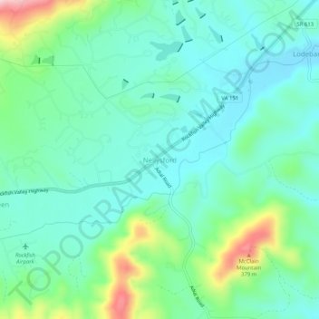
Name: Nellysford topographic map, elevation, terrain.
Location: Nellysford, Nelson County, Virginia, 22958, United States (37.87042 -78.89224 37.91042 -78.85224)
Average elevation: 791 ft
Minimum elevation: 594 ft
Maximum elevation: 1,394 ft
Nelson County trails, hiking, mountain biking, running and outdoor activities
Other topographic maps
Click on a map to view its topography, its elevation and its terrain.