
Romainville topographic map
Interactive map
Click on the map to display elevation.
About this map
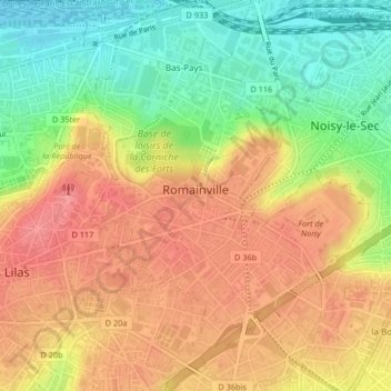
Name: Romainville topographic map, elevation, terrain.
Average elevation: 315 ft
Minimum elevation: 161 ft
Maximum elevation: 443 ft
Other topographic maps
Click on a map to view its topography, its elevation and its terrain.
La Courneuve
France > Ile-de-France > Seine-Saint-Denis > La Courneuve > La Courneuve
Average elevation: 151 ft