
Gardner Butte topographic map
Interactive map
Click on the map to display elevation.
About this map
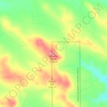
Name: Gardner Butte topographic map, elevation, terrain.
Location: Gardner Butte, Powder River County, Montana, United States (45.32355 -105.86922 45.32365 -105.86912)
Average elevation: 4,108 ft
Minimum elevation: 3,927 ft
Maximum elevation: 4,285 ft
Other topographic maps
Click on a map to view its topography, its elevation and its terrain.
Basin Creek
United States > Montana > Powder River County
Basin Creek, Powder River County, Montana, United States
Average elevation: 3,307 ft
Broadus
United States > Montana > Powder River County > Broadus
Broadus, Powder River County, Montana, 59317, United States
Average elevation: 3,054 ft
Olive
United States > Montana > Powder River County > Olive
Olive, Powder River County, Montana, United States
Average elevation: 3,284 ft