
Flanders topographic map
Interactive map
Click on the map to display elevation.
About this map
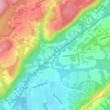
Name: Flanders topographic map, elevation, terrain.
Average elevation: 837 ft
Minimum elevation: 617 ft
Maximum elevation: 1,204 ft
Other topographic maps
Click on a map to view its topography, its elevation and its terrain.
Budd Lake
United States > New Jersey > Morris County > Mount Olive
Budd Lake, Mount Olive, Morris County, New Jersey, United States
Average elevation: 1,027 ft
Bartley
United States > New Jersey > Morris County > Mount Olive
Bartley, Mount Olive, Morris County, New Jersey, 07836, United States
Average elevation: 758 ft