
Hechtel topographic map
Interactive map
Click on the map to display elevation.
About this map
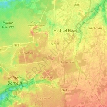
Name: Hechtel topographic map, elevation, terrain.
Location: Hechtel, Hechtel-Eksel, Maaseik, Limburg, Vlaanderen, België (51.08775 5.26804 51.14491 5.39824)
Average elevation: 203 ft
Minimum elevation: 128 ft
Maximum elevation: 246 ft
Other topographic maps
Click on a map to view its topography, its elevation and its terrain.
Eksel
België > Limburg > Maaseik > Hechtel-Eksel
Eksel, Hechtel-Eksel, Maaseik, Limburg, Vlaanderen, België
Average elevation: 187 ft