
Thank you for supporting this site ❤️
Make a donation
Make a donation
Gear up for your next adventure:
As an Amazon Associate, this site earns from qualifying purchases at no extra cost to you.
Winner topographic map
Click on the map to display elevation.
Thank you for supporting this site ❤️
Make a donation
Make a donation
Gear up for your next adventure:
As an Amazon Associate, this site earns from qualifying purchases at no extra cost to you.
About this map
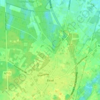
Name: Winner topographic map, elevation, terrain.
Location: Winner, Eksel, Hechtel-Eksel, Maaseik, Limburg, 3941, België (51.14593 5.37205 51.18593 5.41205)
Average elevation: 187 ft
Minimum elevation: 157 ft
Maximum elevation: 213 ft
Thank you for supporting this site ❤️
Make a donation
Make a donation
Gear up for your next adventure:
As an Amazon Associate, this site earns from qualifying purchases at no extra cost to you.