
Salekhard topographic map
Interactive map
Click on the map to display elevation.
About this map
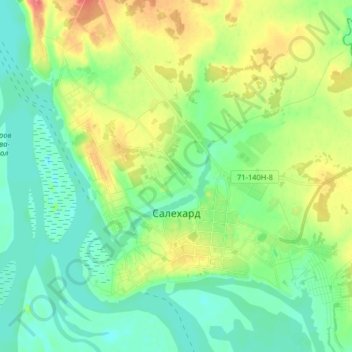
Name: Salekhard topographic map, elevation, terrain.
Average elevation: 59 ft
Minimum elevation: 0 ft
Maximum elevation: 171 ft
Other topographic maps
Click on a map to view its topography, its elevation and its terrain.
ТРРЛ-60 Серов — Воркута, 4/60 (1/103) «Чайка»
Russia > Yamalo-Nenets Autonomous Okrug > Salekhard
ТРРЛ-60 Серов — Воркута, 4/60 (1/103) «Чайка», 71-140Р-1.13, Аксарковское сельское поселение, Priuralsky Rayon, Yamalo-Nenets Autonomous Okrug, Ural Federal District, 629002, Russia
Average elevation: 269 ft