
Hutchinson Island topographic map
Interactive map
Click on the map to display elevation.
About this map
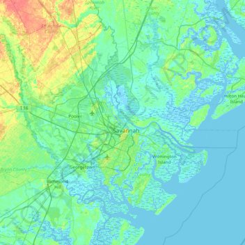
Name: Hutchinson Island topographic map, elevation, terrain.
Location: Hutchinson Island, Chatham County, Georgia, 31421, USA (31.77826 -81.42289 32.41826 -80.78289)
Average elevation: 23 ft
Minimum elevation: -20 ft
Maximum elevation: 138 ft
Other topographic maps
Click on a map to view its topography, its elevation and its terrain.