Geolocate

Tybee Island topographic map

Click on the map to display elevation.

About this map

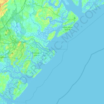
Name: Tybee Island topographic map, elevation, terrain.

Location: Tybee Island, Chatham County, Georgia, 31328, USA (31.69549 -81.18122 32.33549 -80.54122)

Average elevation: 7 ft

Minimum elevation: -20 ft

Maximum elevation: 112 ft

Gear up for your next adventure:

📡GPS Antenna Upgrade - Enhance GPS reception in remote terrain
🔥Camping Stove - Portable stove for camping and backcountry cooking
🎒Gear Packing Cubes - Organize your backpack efficiently
📚Navigation Handbooks - Master the art of reading topographic maps and using a compass
👟Trail Running Shoes - Lightweight shoes for trail runners

As an Amazon Associate, this site earns from qualifying purchases at no extra cost to you.