
Lenoir City topographic map
Interactive map
Click on the map to display elevation.
About this map
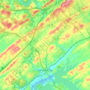
Name: Lenoir City topographic map, elevation, terrain.
Average elevation: 922 ft
Minimum elevation: 748 ft
Maximum elevation: 1,201 ft
Loudon County trails, hiking, mountain biking, running and outdoor activities
Other topographic maps
Click on a map to view its topography, its elevation and its terrain.
Lenior City Area Recreation Complex
United States > Tennessee > Loudon County > Lenoir City > Silver Ridge
Average elevation: 892 ft