
Inkhundla Nkhaba topographic map
Interactive map
Click on the map to display elevation.
About this map
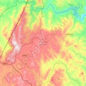
Name: Inkhundla Nkhaba topographic map, elevation, terrain.
Location: Inkhundla Nkhaba, Hhohho, Eswatini (-26.28279 31.01816 -26.03427 31.30903)
Average elevation: 3,750 ft
Minimum elevation: 1,644 ft
Maximum elevation: 6,020 ft
Other topographic maps
Click on a map to view its topography, its elevation and its terrain.