
Town of Bainbridge topographic map
Interactive map
Click on the map to display elevation.
About this map
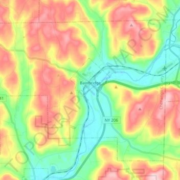
Name: Town of Bainbridge topographic map, elevation, terrain.
Average elevation: 1,316 ft
Minimum elevation: 938 ft
Maximum elevation: 1,804 ft
Chenango County trails, hiking, mountain biking, running and outdoor activities
Other topographic maps
Click on a map to view its topography, its elevation and its terrain.
South Plymouth
United States > New York > Chenango County > Town of Plymouth
Average elevation: 1,375 ft
Nineveh Junction
United States > New York > Chenango County > Town of Afton
Average elevation: 1,138 ft